Temporal Analysis of Satellite Images
Many years ago EARSeL began the process of establishing a Special
Interest Group on time series analysis of remotely sensed data. This
action was stimulated by the open and mostly free access to satellite
data archives providing the opportunity to study, for example,
environmental changes over a period of more than 30 years which is the
minimum time needed to study impacts of climate change. It is no
surprise that timeseries analysis of satellite data is a
growing field of interest in various scientific disciplines and the use
of “old” data experiences a kind of renaissance. Furthermore there is
intensive use of new sensors providing data with global coverage in a
very short time-scale and enabling in-depth analysis of environmental
processes and anthropogenic impacts.
.


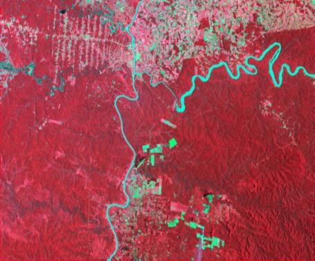
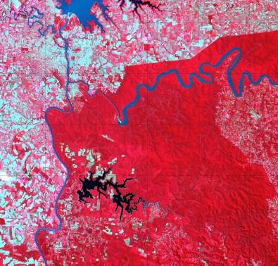
Land use change at
UNESCO World Heritage Site Iguaçu
National
Park
between 1973 and 2011 (Landsat); vegetation is shown in red, deforested
areas in light red and blue colour.
The following topics are interesting examples of this SIG:
- overview of existing data archives, e.g., Landsat, NOAA-AVHRR, MODIS, ERS 1 and 2, InSAR, etc.
- Multitemporal data calibration and correction, and on geometric accuracy of old satellite data
- Existing tools for time series analysis in commercial software packages
- Development of improved/sophisticated change detection algorithms
- Vegetation dynamics, ecological processes and environmental impact
- Applications of multitemporal data
The activities of this Special Interest Group are closely related to many other EARSeL SIGs. Therefore a close co-operation is foreseen. The development of sophisticated algorithms is an especially important task that creates collaboration possibilities that multiple SIGs can benefit from.
The Special Interest Group Temporal Analysis of Satellite Images is chaired by
Chair: Prof. Eberhard Parlow
University Basel, Switzerland.
Co-chair: Prof. Yifang Ban
KTH, Royal Institute of Technology, Stockholm, Sweden.
